
Sponsored Find a Solicitor — free quotes via ReallyMoving
Land
Next Steps
Sponsored — free quotes via ReallyMoving
Find a Solicitor
Land purchases need specialist legal advice — compare fees
Our Summary
- NITRATE VULNERABLE ZONE The land is within a Nitrate Vulnerable Zone and is subject to the usual restrictions
- UPLIFT PROVISION / OVERAGE CLAUSE: Should the land be used for a non-agricultural purpose, whether or not Planning Permission is granted, an Overage Payment of 30% of the uplift in value will be payable to the Vendor or their successors in title
- It is not envisaged that an Equine use would trigger the Uplift Provision
Get alerted when similar properties are listed — Subscribe
Description
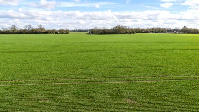
The property is comprised of eight lots of bare agricultural land, with a total of 273.19 hectares (675.55 acres) across different locations. Five of the lots contain areas of trees or woodland, including woodlands with names such as "Deadwood", "Jamies'", and "Woodditton Road". Each lot has a unique size and boundaries, with some accessed off specific roads such as Water Lane, Woodditton Road, and Dalham Road.
The land is classified as Grade 2 land, with Hanslope Soil Series, and includes some slowly permeable clayey soils and landslips. Some of the lots are within a Nitrate Vulnerable Zone and subject to usual restrictions.