
Sponsored Get a Survey — free quotes via ReallyMoving
Property
Next Steps
Sponsored — free quotes via ReallyMoving
Get a Survey
Check the property matches the approved plans — compare up to 5 quotes
Our Summary
- 5 hectares) or thereabouts of agricultural land with the benefit of planning permission for residential development
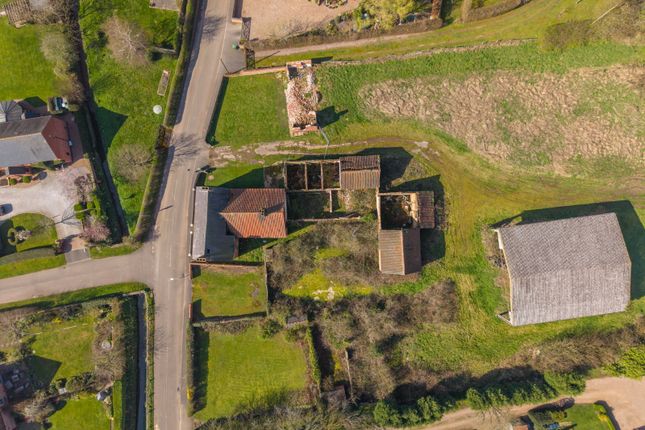
- The site comprises a range of traditional farm buildings, now in disrepair and requiring redevelopment
- Planning The site is located within the jurisdiction of Newark and Sherwood District Council and benefits from planning permission for “Conversion of farm buildings to two dwellings (Plots 2-3) and rebuilding of one barn on existing footprint to form one dwelling (Plot 4)
- ” (Planning ref: 23/00709/FUL)
Get alerted when similar properties are listed — Subscribe
Description
The property consists of 3.7 acres (1.5 hectares) of agricultural land in Egmanton, Nottinghamshire, situated on the northern side of Kirton Road. The land includes traditional farm buildings in disrepair, a paddock, and an area of spinney. The site rises gently from south to north, with a shallow gradient of approximately 10 meters over a 200-meter distance, reaching a height of about 50 meters above Ordnance Datum at the northern boundary.
The land is largely within Flood Zone 1, with a small area of Flood Zone 2 at its southern edge. The site also adjoins several listed buildings, including a Grade I church and Grade II farmhouses. The land includes planning permission for the conversion and rebuilding of farm buildings to form five dwellings, subject to conditions, including the commencement of development within three years.