Sponsored Find a Solicitor — free quotes via ReallyMoving
Land
Next Steps
Sponsored — free quotes via ReallyMoving
Find a Solicitor
Land purchases need specialist legal advice — compare fees
Our Summary
- Additional access gates could be created, subject to obtaining the necessary planning permission
Get alerted when similar properties are listed — Subscribe
Description
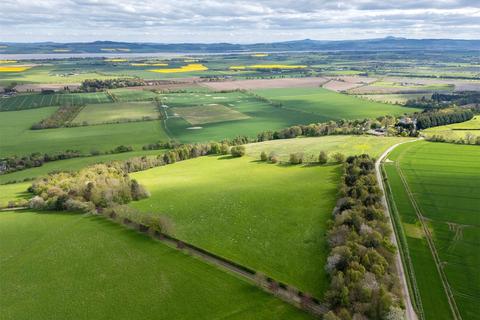
Lot 4 is a parcel of farmland extending to approximately 24.43 hectares (60.39 acres) located within the Carse of Gowrie. The land lies between 80m and 170m above sea level, with an average annual rainfall of 748 mm. It is classified as mainly Grade 3(2) with areas of 3(1) and 4(1) on the James Hutton Institute Land Capability for Agriculture Plans.
The soil is a brown soil with good drainage, freely draining and part of the Sourhope Association. The land is not at risk of river or surface water flooding, according to SEPA Flood Risk Maps. Field boundaries are in good condition, and wayleaves are in favor of SGN and BT.
The land is registered for IACS purposes and the farm code is 89/696/0031. The land is also included in the Basic Payment Scheme (BPS) and the mineral rights are included in the sale.